Photo by Karen Bradbury ()
Standing atop the Rotenfels, there’s so much there to please the eye: a sweeping view of distant peaks and plains, a castle begging for exploration, brick-red cliff faces, verdant fields, vineyards awaiting warmer days, a winding river and a steeple-dotted village. From time to time, a train goes by, its tiny scale adding to the sense you’re gazing out an airplane window.
The claim to fame of this particular gem of German geography is that at 656 feet, the Rotenfels, literally the “red cliff,” is the highest sheer rock face north of the Alps.
On a brisk but sunny January afternoon, a friend and I set out to conquer the Rotenfels. Our outing began with a train ride to Bad Kreuznach, an often-underestimated spa town. A ten-minute walk through the heart of the town, passing over the bridge forming the centerpiece of the town’s “Little Venice” section and a descent to the banks of the Nahe River brought us to the start of the Panoramaweg.
The sights came at us fast apace as we began our gentle ascent. There’s the pretty peach-pink Pauluskirche — the church where Karl Marx pronounced his wedding vows as well as a riverside spa complex. Several minutes into the walk, a red and white gate rises to your right while to the left, you catch sight of the saline inhalation walls that are key to Bad Kreuznach’s “cure town” status.
We then ventured off from the Panorama Way in favor of a trail guiding us to Rotenfels and began gaining elevation at a much quicker pace. The view gained in scope, now allowing us to see the vineyards on the far side of the Rhine by Rüdesheim, while looking the other way, the castle-ruin topped Rheingrafenstein. We appreciated how the barren winter branches allowed us a much freer view than we could ever enjoy in greener seasons of the year.
I’ve done hikes up the Rotenfels a pair of times before, each time taking a slightly different route. I can’t vouch for this day’s hike to have represented the shortest scramble up the backside of the mountain, but the area’s so well marked it’s hard to veer too far off course, just as long as you follow the frequent signage pointing to Rotenfels Bastei.
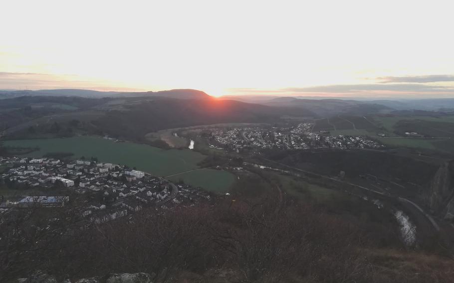
A couple more miles of pretty trails brought us to our day’s goal, the Bastei. Our timing was such that we managed to catch the exact moment of the winter sun dropping below the horizon.
Get out and go: Bad Kreuznach is a 55-minute drive from Kaiserslautern and 45 minutes from Wiesbaden. Beer and wine lovers will be pleased to know that by train, the same journey takes one hour or 46 minutes from these same two cities respectively. There’s a big parking lot by the train station and several others in town. The beauty of this walk is that it once you’ve reached neighboring Bad Münster am Stein, you can just take the train or bus back to your starting point, or opt for an easy walk back alongside the Nahe River. Bad Muenster itself offers a handful of good cafes and a pretty park with saline walls to cure respiratory ailments. The red stone cliff that looms above it gives the park a hemmed in yet protected feel. A sampling of flights and a tasty dinner of regional products at the craft beer restaurant Das Brauwerk brought my outstanding day of hiking to its delicious conclusion and would surely do the same for the next round of hungry hikers.
For more on hiking by the Nahe River and taking on the magnificent TourNatur, see Bad Kreuznach Tourist.